
Criora climate risk
Climate and disaster risk for any place on Earth: this week's weather risk, hazards nearby, long-term climate exposure, country risk for 194 countries, and an interactive map in the chat.
 View in the Claude registry
- Brand
- Criora
- Category
- Data & Analytics
- Primary Subcategory
- Sector, Macro & Alternative Data Intelligence
Integration details
Description
Criora answers climate and disaster-risk questions about any place on Earth and any of 194 countries, from open scientific data, with every figure citing its source. For a place (a city, an address or coordinates): - assess_place: everything in one answer: this week's forecast risk by day, hazards nearby, headline climate exposure and the country's risk - get_forecast: 7-day weather and weather risk (heat and cold stress, wind gusts, heavy rain, snow) - get_hazards_near: wildfires, earthquakes, floods, tropical cyclones, volcanoes, droughts and air quality near a point right now - get_climate_profile: long-term exposure: flood depth, sea level rise, extreme heat, warming to 2050 and 2080, drought, water stress - find_place: resolve a place name to coordinates For countries: - get_country_profile: overall risk, its five dimensions and ~160 indicators benchmarked against the region and the world - compare_countries: 2 to 10 countries side by side - rank_countries: the countries most or least at risk, overall or on one dimension, within a region or income group search and fetch read countries, places and the methodology and sources pages as citable documents. On a map, right in the chat: - show_risk_map: an interactive map of the place: this week's forecast risk with hazard symbols, or the rain, temperature or wind forecast hour by hour with animated wind streams, under the hazard events nearby. Pan, zoom, open it full screen, play the week and switch between the four; the week's timeline shows the reading at the place. Try: "Is it safe to travel to Dubai next week?", "Show me the wind forecast on a map around Bergen", "Compare flood and heat exposure of Lisbon, Valencia and Split by 2050", "Which countries in Southern Asia are most exposed to climate risk?" Data: INFORM Risk Index (EC JRC), ND-GAIN, World Bank, CMIP6, ERA5, IPCC AR6 sea level, WRI Aqueduct, GloFAS, GDACS, NASA FIRMS, OpenAQ and the ECCC GDPS weather model. Free, read-only, no account needed.
- Integration type
- Connector
- Verification status
 Community connector
- Platform
- Claude
- Primary Subcategory
- Sector, Macro & Alternative Data Intelligence
- Secondary Subcategories
- None listed
- Brand
- Criora
- Access
- No account required
- First tracked
- 2026-10-14
- Tool count
- 11
- Geography
- US
The Primary Subcategory used for this profile’s headline score.
Other Subcategories where the Integration is listed.
 Agent DiscoverabilityClaude Discoverability Score
Claude Connector discovery is coming soon
Community Connectors only appear in Claude’s registry.Once verified, organic discovery begins and we can calculate your score.Read more about Community Connector verification.
No spam. Unsubscribe any time.
What discovery looks like
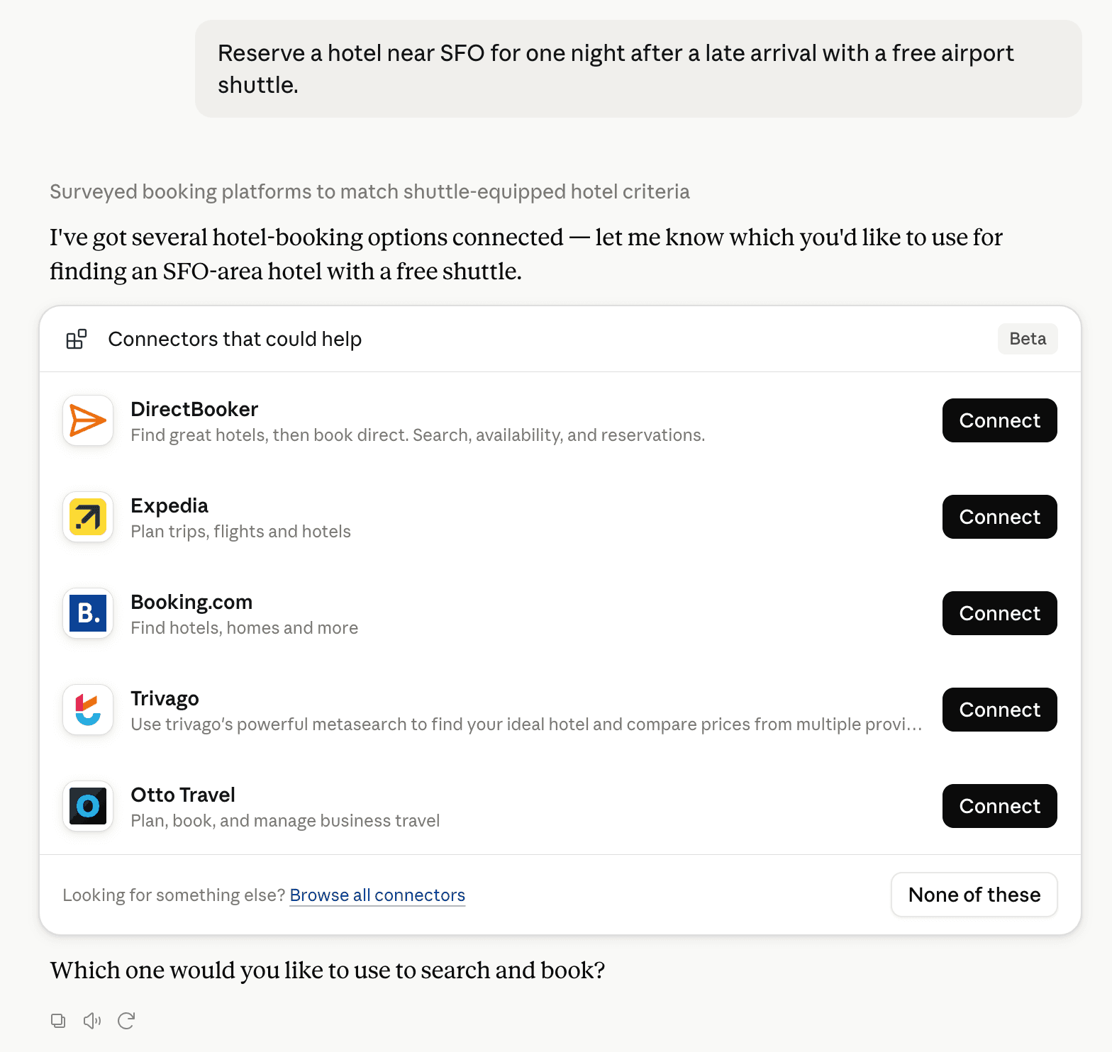
Claude can surface verified Connectors when they match a user’s Prompt.
How Claude Connector discovery works
Your Connector will compete to appear for users’ Prompts once Claude verifies it
Competing in Claude Sector, Macro & Alternative Data Intelligence
View Category
11 tools agents can invoke

Criora climate risk Claude Connector FAQ
How the directory, categories and Discoverability Score work.
Read the methodologyHow do I improve Criora climate risk's Claude Connector discoverability?
The levers are the listing surface agents actually read: names, descriptions, keywords, tool metadata, and registry health. Which lever matters depends on where discovery breaks, which is what continuous measurement shows.
What are Criora climate risk alternatives on Claude?
As of 2026-10-26, Criora climate risk competes with CB Insights, S&P - Deterministic Retrieval, S&P Global - Adaptive Retrieval, Semrush, Bigdata.com, FactSet AI-Ready Data, PitchBook Premium, Crunchbase and 61 more in Claude Sector, Macro & Alternative Data Intelligence, ranked by public Discoverability Score.
Where is this profile measured?
This profile uses the geography attached to the latest public registry snapshot: US. Locale tags are intentionally omitted.